
We headed to Banff National Park. We visited the visitor center and learned it’s the oldest national park in Canada, established in 1885. We liked the park’s new logo.

We set up camp in the Lake Louise campground. We had forgotten to charge our air mattress pump, but luckily Pete figured out how to use our bike pump to inflate our air mattress.

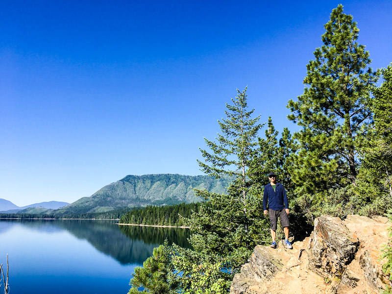
The campground was near the Bow River.

The next day we took a hike from the campground. We crossed over the Bow River a few times.

Right away we started seeing lots of wildflowers.

From Lake Louise we started hiking up towards Lake Agnes. The park has good signage about staying on the paths to keep from trampling the wildflowers.

It was peak wildflower time, and we were happy to see delphiniums.

We hiked up to Lake Agnes.

It was obvious this part of the park was formed by glaciers.

The next day we drove to Moraine Lake. This is a wildlife crossing bridge that enables wolves, coyotes, deer and bears to safely cross the highway.

There are also wildlife crossing underpasses and all are equipped with motion activated cameras. We liked seeing such a big number of safe crossings!

At Moraine Lake this couple getting ready to take wedding photos.

We didn’t rent a canoe, but we did admire all the colorful boats.

We hiked up the trail toward Eiffel Lake, enjoying the views of the rugged Rocky Mountains.

We had purchased hiking poles and this was our first hike to try them out.

We like hiking with poles, especially when the trail is hilly.

These Western Anemone wildflowers were already going to seed.

Lots of wildflowers made it a colorful hike.

Even as the terrain became rocky, we saw clumps of wildflowers.

Here’s a view of Eiffel Lake in its incredible surroundings, reflecting the snowy mountains.

On our third and final day in Banff we drove north to Bow Lake. The hike to Bow Glacier Falls started along the lake. We loved seeing the spectacularly blue-green water caused by rock silt.

Away from the lake it was dry and rocky. Behind Pete is the winding river and the falls.

The patterns in the rocks were interesting.

And the falls were incredible.

After hiking back we drove to Jasper National Park. The town of Jasper is inside the national park. This is the Two Brothers Totem that was installed in Jasper in 2011, to celebrate Parks Canada’s centennial.

The bottom of the totem has a dragonfly. The finished totem pole is almost 14 meters tall and is painted in traditional First Nation Haida colors of red, black and blue.

The next day we went for a bike ride. As Kristina posed for this photo with our tandem we heard the sound of thunder in the distance. We hopped back on the bike and pedaled as fast as we could, but we had to ride almost an hour in the rain.

The rain let up but the sky remained cloudy for a few days. We camped near the Athabasca River, and enjoyed walking along it.


The Athabasca is fed by glacial melt, so it has the characteristic milky-blue color. Here you can also see the currents in the river.

This is a Bearberry plant. The First Nation’s people called them Kinnikinnik.

The campgrounds had brand new, heated bathrooms with hot and cold water!

We even went to ranger-led ‘campfire’ program that was fun, although there was no campfire due to a fire ban. Here the girl on the left is practicing putting out forest fires (by spraying the other kids holding fire photos).

The next day we hiked Opal Hills in Jasper. The trail was partly closed because of a female grizzly bear and her cub.

We both wore our new hiking packs and enjoyed climbing up above the tree line.

In the high meadows were lots of wildflowers, like Pink Mountain Heather.

This is Moss Campion, with charming pink flowers.

But we aren’t sure what this showy pink flower is.

There was lots of Yellow Mountain Heather.

We didn’t see any bears on Opal Hills, but the views were amazing.

A nice couple took this photo for us. Yes, it was cold and windy up top!

As we climbed down there were Bunchberries, the smallest of the dogwoods.

As we drove toward Maligne Canyon we saw this black bear.

We could also see quite a few dead trees, evidence of the mountain pine beetle outbreak exploding in the past four years.

We hiked the fascinating Maligne Canyon, unknowingly starting backwards where the Maligne River is at its largest.

We could see spectacular currents and waterfalls in the river as we hiked up toward the canyon.

Maligne Canyon is actually a gorge and at points it’s 50 meters deep. It was impressive to see how fast the water roared.

The walls of the gorge are made of limestone. We were not surprised to learn that the Canadian Rocky Mountain Parks are a UNESCO World Heritage Site.

The next day we drove out to Miette Hot Springs. On the way we saw an elk grazing by the side of the rode.

We also were in a mountain goat traffic jam, as this herd of about 15 goats paused to lick salt from the road as they crossed.

Founded in 1936, Miette Hot Springs are the hottest mineral springs in the Canadian Rockies.

Water flows from the mountain at 54°C but is cooled to 40°C for their outdoor pools. We decided to soak before we took a hike.

As we started to hike, we spotted this huge dragonfly.

Our hike was on the Sulphur Skyline trail. The scenery was rugged and beautiful.

We saw different wildflowers as we hiked, but we don’t know their names.


It was a steep climb, but the views at the top were worth the effort!

It was windy and cold at the top, so we put on our jackets.

The next day we hiked on Mount Edith Cavell. The glaciers have mostly retreated, leaving behind a rocky landscape.

It was chilly as we walked through the meadow that led to the summit.

Beautiful paintbrush in reds and pinks dotted the meadow.


The marmots went about their business of foraging and didn't seem bothered by the hikers. It was fun to watch them.

At the right of the photo is what is left of the hanging Angel Glacier, with its out-swept wings.

Hiking in Jasper National Park was spectacular, and we are glad that we visited!

In this photo the Angel Glacier’s distinctive green color comes out, as it does in the Edith Cavell Lake.

We left Jasper and drove to Glacier Waterton National Park. We had visited Glacier in 2014 and blogged about the park's history and geology. When we arrived we saw the iconic Jammers.

This photo on the Going to the Sun road looks like the Jammers’ logo.


Impressively steep cliffs tower over the road.

The impact of the glaciers on the landscape was clear.


Behind Pete is Heaven's Peak at 2,793 meters.

There was lots of Fireweed in the meadows.


There are less than 30 glaciers left in Glacier. Snow along the road seemed to be a magnet for other visitors.

The warning sign, “Danger, unstable snow, keep away” didn’t seem to deter people from getting really close.

It was really pleasant to camp and we didn’t need our rain fly on the tent at night.

Glacier is a dark sky preserve. Pete was able to get this photo around midnight.

Our two burner propane stove worked well for making one pot meals and boiling water.

Pete is enjoying a bowl of oatmeal and coffee for breakfast.

We camped near Lake McDonald.

It was fun to explore this part of Glacier that we hadn't visited in 2014.

Lake McDonald is the largest lake in the park, at 16 km long and 1.6 km wide.
In 2003 13% of Glacier burned in forest fires started by lightning. We hiked the Rocky Point Nature Trail and learned how important fire is for regenerating the forest.

To the left of the lake you can see what remains of the ‘fire mosaic’, the burn pattern that includes areas untouched by fire to sections that were completely burned.

The lake was a great place to cool off with an afternoon swim.

Next we’ll be cycle touring through southwest Montana.