
It was fun to sample their sour beers and eat lunch there.

Since we're traveling all over Colorado with our tandem bike, we're riding in as many places as possible. Our ride in Boulder was called Venus de Miles, which is an annual organized ride and also happens to be the name of a women's cycling club.

It made us happy to see lots of other cyclists as we rode, like these two women dressed in Outdoor DIVAS kits, which is another Boulder female cycling club.

Next we went to Fort Collins for a week and a half. The riding there was fantastic! For a couple of days we rode the Fort Collins bike trails. Here’s Pete on the Pioneer Trail, which was just a block away from our Airbnb.

This nature area on the Fossil Creek Trail rolled through pleasant meadows where we could hear the distinctive song of the meadowlark.

Also on the trail system was a raptor observation blind.

It was midday when we got there so we didn’t see any raptors. But here’s the view from the blind.

Fort Collins has over 55 kilometers of bike trails and 450 kilometers of bike lanes on the roads of the city, making it easy to get around by bicycle. This Cycologist sculpture on one of the bike trails was created by Todd Kundla and Andrew Bohn.

Pete is demonstrating the bike fix-it station on the backside of Cycologist.

The Spring Creek Trail included some wonderful bridges that crossed over the creek several times.

And this part of the Mason Trail included a winding pathway that lead to an underpass. Unfortunately it wasn't really designed with tandem bikes in mind and the corners where a bit tight, so Pete decided to proceed down it alone while Kristina took the stairs and met him at the bottom.

This is a traffic activation button for cyclists to get a green light, and it's placed perfectly so we didn't have to get off the bike to press it. It's great that the Fort Collins bike routes are so well-planned and well-equipped!

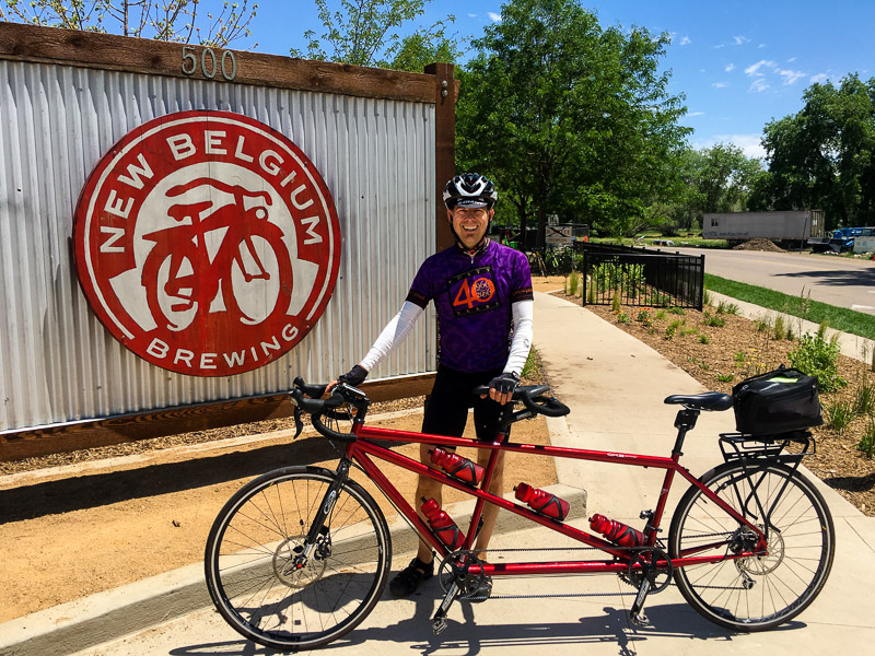
The trails are also well-used, so when we didn't feel like riding slowly and dodging pedestrians, we took to the roads. Pete is in front of the New Belgium Brewing Company. We were interested to learn that New Belgium has been awarded the Platinum Bicycle Friendly Business award.
On Saturday we saw the Colorado Tandem Club out for a ride. There were about 20 tandems.

This is Horsetooth Mountain Reservoir.

The sign for Horsetooth Mountain gives a visual clue for its name.

We could then see the rock formation at the top of the mountain that gives this area the name Horsetooth.

Climbing up from the reservoir we passed this couple who were on a week long self-supported ride. They had lots of gear because they were camping.

Out past Horsetooth Reservoir in the Roosevelt National Forest were some of the prettiest roads we found. The Stove Prairie School started in 1896.

Once down from Stove Prairie School, we rode along the Cache la Poudre River and through this tunnel.


There were people rafting down the river. We could hear them laughing as we rode by.

An alternate route from the Stove Praire School we tried was to climb Rist Canyon Road before descending back to Fort Collins. We only did it once because it was such a challenging climb. Here's Pete taking a well-deserved rest at the top.

Fort Collins was full of blooming flowers, like these gorgeous peonies we saw in someone's front yard.

We also saw plenty of wildflowers, both blooming and gone to seed.


And we also saw evidence of a whimsical sensibility, like this tree house and the sign outside a local ranch.


We rode 7 of the 9 days we were in Fort Collins, feeling ourselves getting stronger and faster, and having lots of fun.

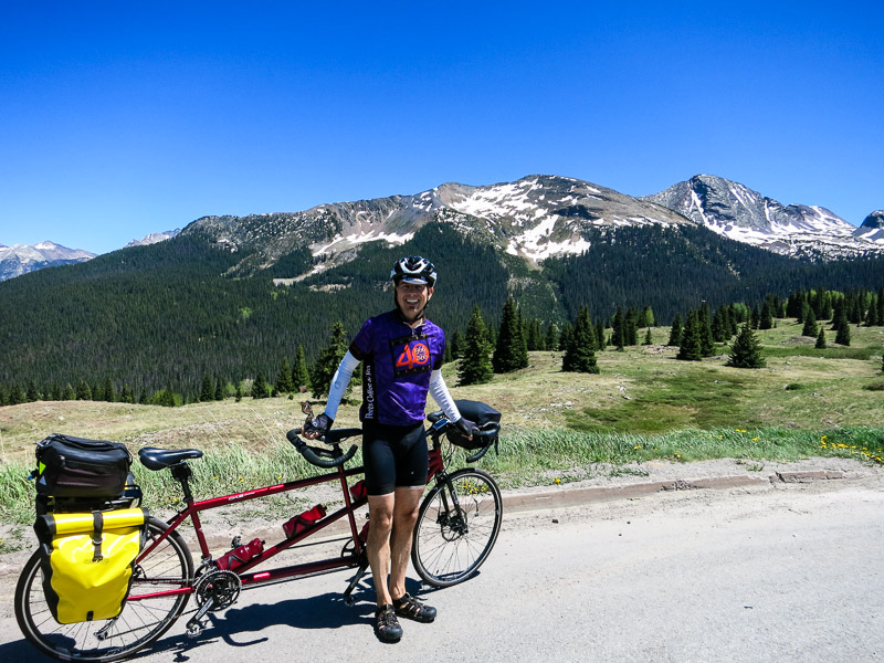
We left Fort Collins for Crested Butte. Along the way, we stopped at Monarch Pass along US Highway 50.

We rode the gondola up to the top.

It was really windy.

The views from the top were spectacular. You can see Highway 50 winding its way through the mountains almost like a river.

We went to Crested Butte and enjoyed walking around the charming town. This is the Old City Hall from 1883.

Hanging flower boxes like this one were on most buildings.

Cycling is also big in Crested Butte, especially mountain biking. We liked this bike store sign.

We drove up to Kebler Pass to check out the wildflowers.

Crested Butte is the wildflower capital of Colorado. We were a bit early for the full show but we saw lots of Yellow Glacier Lilies.


Pete wanted to get a closer shot of these White Marsh Marigolds so he walked across the log.


We didn't see any Colorado Columbines, the state flower, except on this card.

We stayed in a fishing town called Almont.

Across the street was our log cabin.

From the cabin we rode along the Taylor River, which was beautiful.

Near the top of the road we reached the Taylor Reservoir.

The water in the reservoir had that stunning blue color that occurs in the mountains.

This old corral had been turned into a picnic area.

On the way back down to Almont, we saw some rock climbers on the steep canyon walls and were impressed.


After leaving Crested Butte we drove by the Blue Mesa Reservoir.

We went to the Black Canyon of the Gunnison National Park. The steep and deep canyon walls were spectacular.

The name Black Canyon refers to the fact that points in the canyon receive only 33 minutes of daylight each day. It's the steepest canyon with the narrowest walls in the US.

The Gunnison River largely caused the erosion of the canyon, as it flowed downhill at a rapid rate over millions of years.

At 690 meters, the Painted Wall is the tallest sheer cliff in Colorado.

The Ranger at the visitors center told us they call the shapes in the Painted Wall "flying dragons".

The wildflowers in Black Canyon included Lupine.

And we saw pretty blooming Hunger Cacti.

But we didn't linger because the next day we were starting a three day self-supported cycling loop.
Day One: Ouray to Durango, 112 kilometers with 2,085 meters of climbing
Here we are in front of our hot springs hotel at the beginning of the trip. This was our first time to do a self-supported cycling trip on our tandem, and we were both excited and nervous.

Our day started with a 21 kilometer climb up Red Mountain. We stopped a few times to rest and enjoy the scenery. Behind Pete is a waterfall, and next to him is a sign explaining the history of the road and how difficult it was to build.

This close up of the waterfall shows how the stone was eroded by water into steps, that were then pushed vertically.

The roads were in great shape.

Near the summit we saw a mining area that in its heyday had over 100 active mines for gold, silver, lead, zinc and copper. Since the 1980s they've been working to change the drainage pathways to prevent run-off water from going through the mines, which protects the river from contamination.

This was the Treasury Tunnel that connected into 100 miles of underground tunnels. Miners would board trams here to ride to their work stations.

It took us over two hours to climb to the top of Red Mountain, which is at an elevation of more than 3,300 meters.

We're using a Garmin for our route and ride statistics. This is an image of the day's elevation profile with three mountain passes shown.

Travelers like to cover the road signs with stickers.

We had to wait half an hour at the top because of road construction. We saw this classic restored Chevy pulling a trailer while we waited.

The next pass we climbed was Molas, and the views of the San Juan National Forest were incredible!

We liked the contrast of the vibrant pink wildflowers against the alpine scenery.

We rolled into Durango around 5:30. After showering we walked to a nearby restaurant for dinner. Their bike rack was well-used and it had a cool sign.

Day Two: Durango to Rico, 138 kilometers with 1,965 meters of climbing
The next morning we rode through downtown Durango and enjoyed looking at the old buildings, such as the Strater Hotel.

From Durango we headed west along Highway 160. Our first stop of the day was the town of Mancos.

Pete is at the entrance of the Zuma grocery store.

They had house-made cornmeal muffins and fresh coffee, the perfect mid-morning snack.

We had the road pretty much to ourselves in the morning.

Our route followed the San Juan Skyways, with incredible scenery.

Here's a map that shows the Skyway loop. If you're curious, you can see the route in Google Maps.

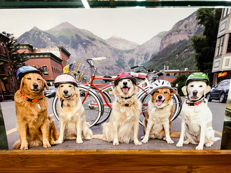
We stopped in the town of Dolores to buy lunch and noticed this awesome photo. Smart dogs wear helmets when they cycle.
The prettiest part of this day’s ride was along the Dolores River.

We had a stand up picnic for lunch next to the river on a small side road.

The trees in the San Juan National Forest looked really healthy and green.

The road crossed over the Dolores River several times.

It was quite hot in the afternoon, so the chocolate frosties were a welcome treat.

Rico is a tiny town of maybe 200 people. We were happy staying at the Mine Shaft Inn and Hostel.

Originally built as a house in the late 19th century, it has been a hotel for over 100 years. The coal stove was restored a few years ago.

This was the view from our bathroom. It felt like we were in a forest.

While the official motto of Rico is "a slice of paradise", we heard that its informal motto is "coming soon" since there is so little development in the town.

We met Café at the only restaurant in town. Like sister Denise’s dogs, Café is a schipperke and super cute.

Day Three: Rico to Ouray, 116 kilometers with 1,641 meters of climbing
We got an early start out of Rico because the weather was heating up.

We continued cruising along the beautiful Dolores River.

We climbed up towards Lizard Head Pass. You can see the distinctive rock on the right.

And here's Pete as close as we got to the lizard head.

As we started our descent we rode passed Trout Lake and this incredible alpine scene.

Behind Kristina and Pete are Sunshine Mountain and Wilson Peak. Wilson Peak is one of The 14ers, Colorado mountains over 14,000 feet; Its height is 4,275 meters.

We saw the most spectacular field of wildflowers with the iconic red mountains of Colorado in the background during our descent from Telluride to Placerville.

The red wildflowers are Fairy Trumpets and the purple ones are Penstemons.

We never got tired of the colorful scenery such as the vibrant green meadows in front of snow-capped, bald peaks, as seen here at Dallas Divide on Highway 62 before Ridgway.

Kristina looks so happy because she is less than 5 kilometers from the end of the ride. Behind her is the Uncompahgre River, named for the eastern Ute tribe.

Ouray is called the Switzerland of America because of its setting at the narrow head of a valley, enclosed on three and a half sides by steep mountains. It did remind us of Switzerland.

We arrived back at the hotel, tired but exhilarated. We took this photo of the cheerful geranium flower boxes and then enjoyed soaking in the hot tub.

We have been avidly watching the Warriors this season, so we are sad that they lost the NBA Championship, but we know that Cleveland played better and deserved to win. Towards the end of our cycling loop we met a fellow fan named Remi and took a photo of him in his Curry jersey. There's always next season!

We'll stay in Colorado another week for family visits, yoga and more cycling!